 With the surge of data from satellites circling our planet, the power of unsupervised learning to sift through this goldmine for insights is transforming how we understand and interact with the Earth. From weaving through the intricacies of land cover classification to ensuring the vigour of our green canopy and leaping into action during disasters, unsupervised learning is reshaping environmental and urban planning.
Unsupervised learning stands out as a remarkable technique within the field of machine learning. Unlike its supervised counterpart, unsupervised learning operates effectively without the need for labeled data. It’s akin to hosting a party and allowing guests to naturally form groups based on shared interests, without the constraints of predefined categories. This methodology is particularly well-suited for analyzing satellite imagery, where vast amounts of data are available, but obtaining labeled data can be costly and challenging.
One of the great features of unsupervised learning is its ability to identify patterns, structures, and relationships within data without explicit guidance. In the context of satellite imagery, this means that the algorithm can automatically detect and categorize various features, such as land cover types, urban areas, water bodies, and more, solely based on the visual information present in the images.
One of the most compelling applications of unsupervised learning in satellite imagery analysis is land cover classification. Traditional methods of land cover classification often rely on labeled training data, which can be time-consuming and expensive to produce. Unsupervised learning algorithms, on the other hand, can autonomously identify and group pixels with similar spectral characteristics, effectively distinguishing between different types of land cover without the need for pre-defined labels.
Another significant advantage – the ability to handle large and complex datasets with ease. With the proliferation of high-resolution satellite imagery and the increasing availability of open-source satellite data, the volume of data to be analyzed has grown exponentially. Unsupervised learning algorithms can efficiently process this vast amount of data, extracting meaningful insights and identifying hidden patterns that may not be apparent to the human eye.
Cluster analysis is another powerful application of unsupervised learning in satellite imagery analysis. Grouping pixels with similar attributes together helps these algorithms identify distinct regions or features within an image, such as agricultural fields, forests, or urban areas. This information can be invaluable for various applications, including urban planning, environmental monitoring, and natural resource management.
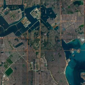
Deconstructing Land Cover with Unsupervised Learning
Land cover classification involvs identifying and categorizing the physical material at the surface of the earth as observed in satellite images. This could range from forests and buildings to water bodies and bare land. Unsupervised learning dives into this task without prior knowledge, categorizing the imagery based on patterns and features it discovers. This ability to classify land cover without explicit instruction unlocks new frontiers in how we map and manage our planet’s resources.
Imagine programming a model that distinguishes urban areas from agricultural fields or differentiates between types of vegetation. This isn’t just valuable for academic research; it’s critical for planners and policymakers. It informs urban development, conservation efforts, and even helps in better agricultural planning, ensuring sustainability and resilience.
Keeping Watch on Vegetation
Vegetation monitoring is another realm where unsupervised learning proves its mettle. With the help of analyzing the changes in vegetation cover over time, unsupervised models help in tracking deforestation, desertification, or the health of natural habitats. These insights are invaluable for environmental conservation, monitoring the impact of climate change, and even aiding in the management of carbon credits.
For instance, a model could identify changes in the green cover of a region across seasons and years, highlighting areas of concern without needing specific guidance on what to look for. This hands-off approach allows for constant monitoring and quick identification of trends that might indicate ecological distress.
Disaster Response
When disaster strikes, every second counts. Satellite imagery combined with unsupervised learning becomes a critical tool in the rapid assessment of damage from events like floods, wildfires, and hurricanes. These models can quickly identify areas of devastation, enabling faster and more targeted response efforts.
This capability isn’t confined to post-disaster scenarios. Predictive assessments of regions prone to natural calamities can prepare responders and residents alike by identifying potential risks and vulnerabilities ahead of time. Thus, unsupervised learning not only aids in immediate disaster response but also in longer-term preparedness and mitigation strategies.
The Backbone of Environmental and Urban Planning
Beyond these applications, unsupervised learning from satellite imagery serves as a foundation for informed decision-making in urban and environmental planning. By offering a detailed, continuously updated view of how land is being used and how it changes over time, policymakers can craft strategies that foster sustainable development, protect natural resources, and enhance quality of life.
Consider the challenge of expanding a city without encroaching on vital green spaces or disrupting local ecosystems. Unsupervised learning can identify optimal areas for development that minimize environmental impact, helping planners balance growth with conservation.
Harnessing the Power: A Practical Example
Let’s put theory into practice with a simple example of using unsupervised learning for land cover classification. We’ll use Python and the Keras library, a powerhouse in the machine learning world for its simplicity and flexibility.
from keras.layers import Input, Dense
from keras.models import Model
from sklearn.cluster import KMeans
import numpy as np
from tensorflow.keras.datasets import mnist
# Load and preprocess data
(x_train, _), (x_test, _) = mnist.load_data() # Just an example dataset
x_train = x_train.astype(‘float32’) / 255.
x_test = x_test.astype(‘float32’) / 255.
x_train = x_train.reshape((len(x_train), np.prod(x_train.shape[1:])))
x_test = x_test.reshape((len(x_test), np.prod(x_test.shape[1:])))
# Define the model
input_img = Input(shape=(784,))
encoded = Dense(64, activation=’relu’)(input_img)
decoded = Dense(784, activation=’sigmoid’)(encoded)
autoencoder = Model(input_img, decoded)
autoencoder.compile(optimizer=’adam’, loss=’binary_crossentropy’)
autoencoder.fit(x_train, x_train,
epochs=50,
batch_size=256,
shuffle=True,
validation_data=(x_test, x_test))
# Use KMeans for clustering
encoded_imgs = autoencoder.predict(x_test)
kmeans = KMeans(n_clusters=10, random_state=0).fit(encoded_imgs)
In this snippet, we used an autoencoder from Keras for dimensionality reduction, a common preparatory step in unsupervised learning. Then, we applied K-means clustering, available from sklearn, to categorize the data. Though the example uses MNIST for simplicity, the same framework applies to satellite imagery analysis, where you’d first preprocess the imagery data, then train an autoencoder to find a compact representation, and finally apply clustering to categorize land cover types.